
Extreme heat is becoming one of the defining challenges for Indian cities. Beyond regional heatwaves, rapid urbanisation is intensifying the urban heat island effect, where heat-absorbing and impervious built surfaces along with declining vegetation cover are leading to hotspots within the cities. Unlike heatwaves, these drivers are shaped by urban planning and development decisions, which means cities can act on them. This report shows how urban heat mitigation can move beyond isolated pilots to become part of routine urban development.
Using a spatial heat hotspot assessment framework applied to Delhi’s Planning Zone F, the report identifies which urban surfaces generate heat, where mitigation opportunities are concentrated, and which interventions offer the greatest cooling potential. Integrated measures such as increasing surface reflectivity, enhancing surface perviousness, and expanding vegetation, can reduce average zonal daytime land surface temperatures by up to 4°C. The framework also allows cities to prioritise action according to local land use and surface characteristics.
The report finds that India’s principal challenge is no longer identifying solutions, but mainstreaming them. Although the country already has many of the policy, planning, financing, and institutional foundations needed to support urban heat mitigation, implementation remains fragmented across sectors and programmes. Heat analytics are rarely translated into planning and investment decisions, while successful pilots seldom scale through routine urban development processes.
To address this gap, the report proposes a National Programme for Urban Heat Mitigation, anchored by the National Disaster Management Authority (NDMA) and supported by a programme vehicle. Rather than creating parallel institutions, the programme integrates urban heat mitigation into existing systems for disaster risk reduction, urban planning, infrastructure development, and financing. This gives cities a coordinated pathway to reduce urban heat while improving liveability, strengthening resilience, and supporting sustainable development.
This report:
- Demonstrates how spatial urban heat analysis can move beyond hotspot mapping to guide planning, investment, and implementation.
- Quantifies the mitigation potential of surface reflectivity, perviousness, and vegetation, with integrated interventions demonstrating daytime surface temperature reductions of up to ~4°C.
- Identifies the institutional, planning, and regulatory barriers that prevent proven urban heat mitigation solutions from scaling.
- Proposes a National Programme for Urban Heat Mitigation to mainstream long-term urban heat mitigation through existing urban development systems.
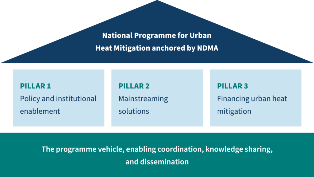 Source: RMI India Foundation analysis.